
ARAG SPRAYING COMPUTER
The company Continental, monitoring developments in the agricultural sector and the needs of farmers for more economical spraying presents you the new precision spraying series of the Italian Company ARAG.
Bravo 180S spray computer
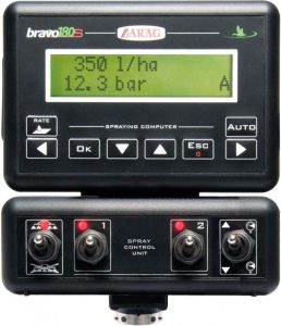
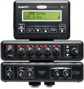
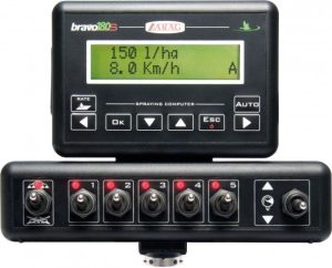
The Bravo 180S is a precision calculator that can be applied to all sprays Continental (Arboriculture and open cultivation) offering very high performance and reducing to a minimum the operating costs of the spraying process. It offers excellent precision and efficiency, designed to control all the necessary functions during spraying. It is easy to use, placed close to the operator and connected to the sprayer's electric control, using a single cable.
Features:
- Systematically adjusts the spray pressure to maintain the pre-selected dosage
- Possibility of instantly increasing or decreasing the spray dosage
- Automatic tank calibration via flowmeter
- Flow or pressure adjustment via indicator (with sensor)
- Automatic shut-off below minimum set pressure to ensure nozzles always operate within their operating range
- Deactivation of the main valve below the minimum speed set by the user
- Temporary increase and decrease in supply
- Version with use and for hydraulic movement of the ramp
Technical characteristics:
- Visual and audible warnings
- Ability to store ten work configurations (spray dosage, etc.) and delete if necessary
- Multilingual software and measurement unit settings (l/ha, GPA, GPK, l/100m etc.)
- Displayed information: application rate, speed, pressure, flow rate, spray amount, tank level, area covered, spray duration, distance covered.
Navigator LT
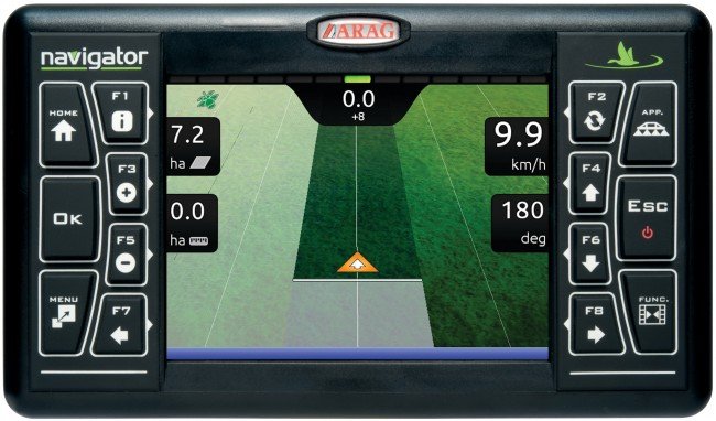
The Navigator LT it is a screen GPS with built-in receiver for application to any type of sprayer Continental.
Features
- 5.7″ high-definition and bright TFT color screen
- User-friendly menu, function and zoom keys and built-in help menu for instant access
- Two camera inputs
- SD memory card slot for data transfer and software upgrades
- 2GB internal memory for storing jobs, maps, machines and tractors
- Interconnection with Glonass satellites, ensuring proper operation even in difficult conditions, such as in installations or buildings
- Colored application zone
- Calculation of field perimeter and area
- Alignment function for use in row crops (corn, sugar beet, cotton, etc.)
- Memorizing a work stoppage point
- Line number display, distance and graphical direction display for returning to
work stoppage point - Choice of day or night operation
- Graphical representation of completed work with display of start and completion points
- Available guidance modes: Parallel, curves, rotation and free
- Export work data in Shape format
- Permanent indications on the screen: deviation from the desired route, route number, speed
movement, direction, applied area, calculated area and field perimeter - GPS data displayed: latitude, longitude, altitude, number of satellites in
connection, HDOP level and DGPS activation or not - Selectable units of measurement: international system (ha, km/h), and US (acre, mph)
- Power supply: 12V DC